Polar Research at UW Oceanography

Arctic oceanography and sea ice research at the University of Washington's School of Oceanography.

home people research papers links


The Chukchi and Lisburne polynyas: Adaptation of the SSM/I method to AMSR-E

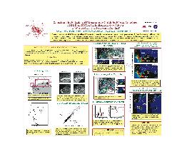
The launch of the Advanced Microwave Scanning Radiometer for EOS (AMSR-E) aboard NASA's Earth Observing System (EOS) Aqua satellite in May of 2002 provides us with passive microwave imaging of the sea ice surface at a higher resolution than with the earlier Special Sensor Microwave Imager (SSM/I) used in our previous studies. By linearly mapping the R37 polarization ratio from the SSM/I to that of the AMSR-E's 36 GHz channels, we are able to adapt the SSM/I thin-ice thickness algorithm to the AMSR, improving the spatial resolution of our ice production estimates from 25km to 12.5km. Because much of the ice production in coastal polynyas occurs within 25km of the coast, the improved resolution allows us to investigate previously invisible small polynyas, as well as to measure larger polynyas with improved accuracy.

In Martin et. al., 2005, we use the AMSR-E to improve our observations of the 2003 Chukchi polynya. The AMSR-E measurements allow us to include roughly 40-50% more ice production that was previously obscured by proximity to land, as well as to discern the structure of the Chukchi polynya as three smaller polynyas. In addition, we investigate a smaller polynya off of Cape Lisburne that could not be studied with the SSM/I.

Martin, S., R. Drucker, R. Kwok, and B. Holt
Improvements in the estimates of ice thickness and production in the Chukchi Sea polynyas derived from AMSR-E
Geophysical Research Letters, Vol.32, L05505, doi:10.1029/2004GL022013, 2005

ABSTRACT For January-March 2003, we use 12.5-km resolution Advanced Microwave Scanning Radiometer (AMSR) data for the first time in a comparison with Synthetic Aperture Radar (SAR) and Special Sensor Microwave/Imager (SSM/I) data to study two Chukchi coast polynyas, one consisting of many, the other of only a few 25-km SSM/I pixels. Within these polynyas, the ice thicknesses are derived separately from the SMM/I 37-GHz and AMSR 36-GHz channels; the heat fluxes are derived by combining thicknesses with meteorological data. Comparison with ScanSAR data shows that for the large polynya, because AMSR provides better resolution of the surrounding coastline and first-year ice, the AMSR heat losses are greater than the SSM/I; for the small polynya, AMSR measures its variability even when its area is of the order of a single SSM/I pixel. This means that AMSR permits more accurate calculation of polynya heat losses, yielding the potential of improved estimates of Arctic polynya productivity.
  • Download PDF, © 2005 American Geophysical Union. Further reproduction or electronic distribution is not permitted.


  • AGU poster